
Plan, Subdivision of portion of the Awanui Estate
Maker
Herald Lithography
Saxby, A G
Production date
Nov 1915
Current rights
Public Domain
See full details
Object detail
Brief Description
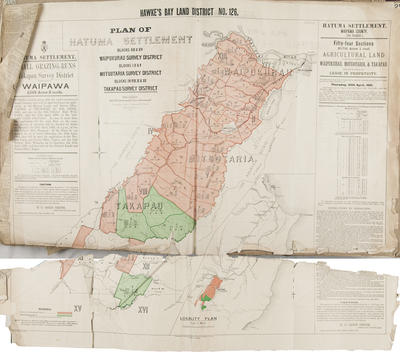
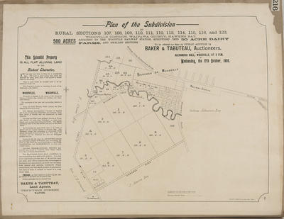
Plan of Awanui Estate land, a portion of which is to be subdivided.
Twenty chains to the inch.
Consisting of 3,416 acres divided into 18 blocks.
The land lots are for sale by public auction at Takapau, on Saturday November 6, 1915, on behalf of Sydney Johnston.
The land lots with area sizes are situated alongside Takapau town saleyards and the railway station is 1/2 mile away. The Marakeke railway station is on the property. The lots are situated around the Wellington to Napier road, Ruataniwha survey district and the Maharakeke Stream, which is near the Motuotaria settlement. A newspaper clipping is included noting the successful bidders:
Lot 3 - 562 acres, £15 per acre - C A Jensen of Dannevirke.
Lot 10 - 230 acres, £20 per acre - C E Twist of Greenmeadows.
Lot 19 - 5 acres, £25 - J Caughley of Takapau.
Production date
Nov 1915
Production place
Production period
Production technique
Media/Materials description
Printed on paper with black and colour ink.
Media/Materials
Measurements
Height x Width: 450 x 570mm
Classification terms
Subject person
Subject period
Subject date
06 Nov 1915
Current rights
Public Domain
Credit line
gifted by the Hawke's Bay Farmers'
Co-Operative Association
Co-Operative Association
Other number(s)
m74/37/2/132, 75462
Public comments
Be the first to comment on this object record.