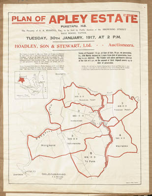
Plan, portion of the Apley Estate purchased by Mr Giblin
Maker
Rochfort, James
Production date
Aug 1879
Object detail
Brief Description
Plan of portion of the Apley Estate purchased by Mr Giblin.
Twenty chains to the inch.
Shows land lots, area sizes, boundary lines around the Mangaone River and the road from Peka Peka and the road to Wairoaiti. The land consists of 5,510 acres. Written on bottom right hand corner is: This plan is compiled partly from the record plans in the survey office and partly of a survey of a fence make by myself, the bearings of the lines of which fence are shown. Signed by James Rochfort.
Production date
Aug 1879
Production place
Production period
Production technique
Media/Materials description
Handwritten and hand drawn in ink, painted by watercolour. Artist's drawing paper.
Media/Materials
Measurements
Length x Width: 670 x 510mm
Classification terms
Subject person
Subject period
Subject date
Aug 1879
Other number(s)
6385, 31156


Public comments
Be the first to comment on this object record.