George Duncan
Share
Copy Link
George Duncan
Made by this person or organisation
Refine Results![Collection of Hawke's Bay Museums Trust, Ruawharo Tā-ū-rangi, [68883]](https://collection.mtghawkesbay.com/records/images/medium/17528/2e98ac15dfb0fda9159d5c9df05351cc2163dbd8.jpg) Name/Title:
Map, Wairoa County, Hawke's Bay County, 1882
Maker:
Duncan, George
Production date:
1882
Accession number:
58/60
See full details
Name/Title:
Map, Wairoa County, Hawke's Bay County, 1882
Maker:
Duncan, George
Production date:
1882
Accession number:
58/60
See full details
Name/Title:
Plan, Ruataniwha Survey District - Makaretu.
Maker:
Duncan, George, Department of Lands & Survey, Baker, Horace
Production date:
30 Mar 1911
See full details
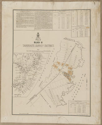
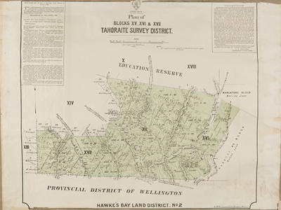 Name/Title:
Plan, Tahoraite SD land for sale
Maker:
Duncan, George, Smith, Stephenson Percy, Department of Lands & Survey, Williams, G W, Price, H G
Production date:
1890
See full details
Name/Title:
Plan, Tahoraite SD land for sale
Maker:
Duncan, George, Smith, Stephenson Percy, Department of Lands & Survey, Williams, G W, Price, H G
Production date:
1890
See full details
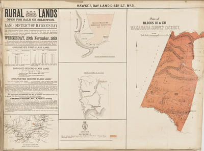 Name/Title:
Plan, Hawke's Bay Land District No 2
Maker:
Duncan, George, Williams, G W, Smith, Stephenson Percy, Department of Lands & Survey
Production date:
20 Nov 1889
See full details
Name/Title:
Plan, Hawke's Bay Land District No 2
Maker:
Duncan, George, Williams, G W, Smith, Stephenson Percy, Department of Lands & Survey
Production date:
20 Nov 1889
See full details
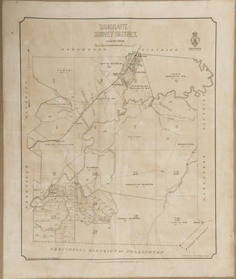 Name/Title:
Cadastral map, Tahoraite district
Maker:
Baker, Horace, Duncan, George, McKerrow, James, Department of Lands & Survey
Production date:
Apr 1887
See full details
Name/Title:
Cadastral map, Tahoraite district
Maker:
Baker, Horace, Duncan, George, McKerrow, James, Department of Lands & Survey
Production date:
Apr 1887
See full details
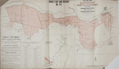 Name/Title:
Plan, Hawke's Bay Land District No 176
Maker:
Department of Lands & Survey, MacKay, John, Duncan, George, Marchant, J W A, Farnie, E H, Brook, T, Department of Lands & Survey, Wilson, James George
Production date:
11 Apr 1905
See full details
Name/Title:
Plan, Hawke's Bay Land District No 176
Maker:
Department of Lands & Survey, MacKay, John, Duncan, George, Marchant, J W A, Farnie, E H, Brook, T, Department of Lands & Survey, Wilson, James George
Production date:
11 Apr 1905
See full details
Name/Title:
Map, Napier High School Endowment Lands, Wairoa
Maker:
General Survey Department of New Zealand, Baker, Horace, Duncan, George, McKerrow, James
Production date:
Dec 1883
See full details
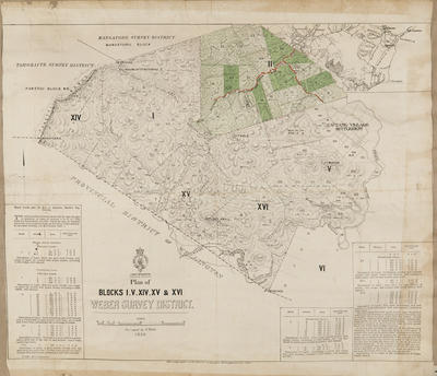 Name/Title:
Cadastral map, Weber Survey District
Maker:
McKerrow, James, Department of Lands & Survey, Duncan, George
Production date:
Jul 1888
See full details
Name/Title:
Cadastral map, Weber Survey District
Maker:
McKerrow, James, Department of Lands & Survey, Duncan, George
Production date:
Jul 1888
See full details
 Name/Title:
Plan, Tahoraite SD land for sale
Maker:
Baker, Horace, Department of Lands & Survey, Duncan, George, McKerrow, James
Production date:
Apr 1884
See full details
Name/Title:
Plan, Tahoraite SD land for sale
Maker:
Baker, Horace, Department of Lands & Survey, Duncan, George, McKerrow, James
Production date:
Apr 1884
See full details
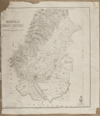 Name/Title:
Cadastral map, Woodville SD
Maker:
Baker, Horace, Department of Lands & Survey, Duncan, George
Production date:
Mar 1885
See full details
Name/Title:
Cadastral map, Woodville SD
Maker:
Baker, Horace, Department of Lands & Survey, Duncan, George
Production date:
Mar 1885
See full details