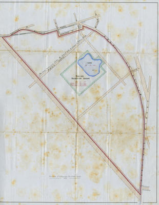
Plan, a new subdivision and park and recreation ground, Napier
Current rights
Public Domain
See full details
Object detail
Brief Description
The plan shows a potential new park and recreation ground in Napier. The area is now Nelson Park. Hastings Street, Wellesley Road, Millar, Faulknor, Owen, Faraday, Sale and Carlyle Streets have been depicted. The outline of a Park Road has been drawn around the Park. There is the outline of a lake in the park.
Date, unknown.
Cartographer, unknown.
Date, unknown.
Cartographer, unknown.
Production place
Production period
Production technique
Media/Materials description
Black and coloured ink on linen.
Media/Materials
Measurements
Height x Width: 575 x 475mm
Classification terms
Subject period
Current rights
Public Domain
Caption
Collection of Hawke’s Bay Museums Trust, Ruawharo Tā-ū-rangi, 2016/5/3
Credit line
gifted by the Port of Napier Ltd
Other number(s)
2016/5/3, 93529
Accession number
2016/5/3


Public comments
Be the first to comment on this object record.