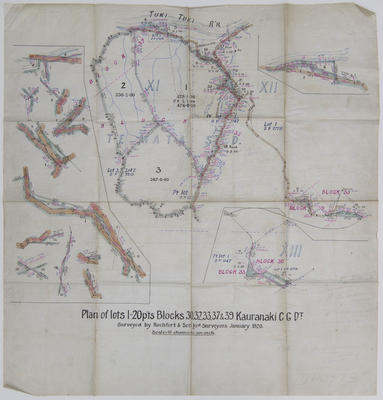
Plan, Te Mata land block XI
Maker
Rochfort & Son
Production date
Jan 1920
Current rights
Public Domain
See full details
Object detail
Brief Description
Plan by Rochfort and Son of Te Mata block XI and dated January 1920.
Plan shows lots 1 to 20 as parts of sections 30, 32, 33, 37 and 39 of Te Mata Block XI along the Tukituki River. Inset plans show closeups of road diversions and boundaries with other blocks. Also includes boundaries, survey marks and distances.
Includes rough noted written in pencil on latitudinal and longitudinal calculations.
Scale is 10 chains to 1 inch.
Maker
Production date
Jan 1920
Production place
Production period
Production technique
Media/Materials description
Drawn and handwritten black and coloured ink on tracing paper.
Media/Materials
Measurements
Height x Width: 740 x 700mm
Classification terms
Subject person
Subject period
Subject date
Jan 1920
Current rights
Public Domain
Caption
Collection of Hawke's Bay Museums Trust, Ruawharo Tā-ū-rangi, m2010/94/31
Credit line
gifted by Cotterill and Humphries
Other number(s)
m2010/94/31, 7830, 85063


Public comments
Be the first to comment on this object record.