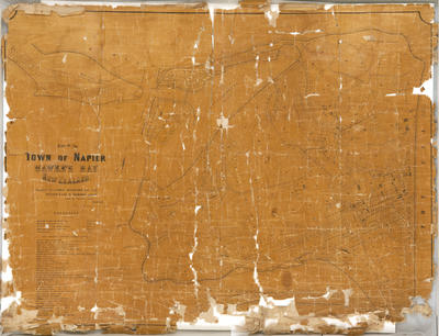
Plan, Town of Napier
Maker
Rochfort, Guy
Lyndon, Edward
Hamel & Ferguson Printers
Production date
Circa 1890
Current rights
Public Domain
See full details
Object detail
Brief Description
Plan of the town of Napier circa 1890, published by Edward Lyndon and compiled by Guy Rochfort.
The plan shows sections in Westshore, Ahuriri, Bluff Hill and Hospital Hill area divided along boundaries with lot numbers, owners and acreage. References are given for land belonging to the Hawke's Bay Education Board, Napier Harbour Board, Napier Municipal Corporation and Hawke's Bay Church Trust. Also given is a list of public buildings, churches, chapels and schools each with a specific number. Roads and rail lines are also shown.
Printed by Hamel and Ferguson of Melbourne.
Unknown scale.
Production date
Circa 1890
Production place
Production period
Production technique
Media/Materials description
Printed black ink on linen paper.
Media/Materials
Measurements
Height x Width: 850 x 1110mm
Classification terms
Subject person
Subject period
Subject date
Circa 1890
Current rights
Public Domain
Other number(s)
7813, 83371


Public comments
Be the first to comment on this object record.