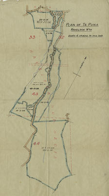
Plan, Te Mata district land
Production date
Circa 1913
Current rights
Public Domain
See full details
Object detail
Brief Description
Plan of lot 1 to 8 of block 9, Te Mata C G D, block IV Te Mata survey district.
Deposited plan No 2141.
Shows 9 land lots with area sizes.
Deposited plan No 2141.
Shows 9 land lots with area sizes.
Production date
Circa 1913
Production place
Production period
Production technique
Media/Materials description
Tracing paper and drawn in pencil.
Media/Materials
Measurements
Height x Width: 385 x 325mm
Classification terms
Subject period
Subject date
Circa 1913
Current rights
Public Domain
Caption
Collection of Hawke's Bay Museums Trust, Ruawharo Tā-ū-rangi, m2010/94/10
Credit line
gifted by Cotterill and Humphries
Other number(s)
m2010/94/10, 7606, 79118


Public comments
Be the first to comment on this object record.