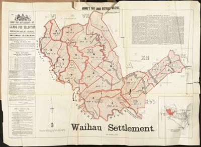
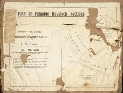
Map, Waihau Settlement
Maker
MacKay, John
Production date
11 Mar 1913
Current rights
Public Domain
See full details
Object detail
Brief Description
Map of Waihau Settlement - Patoka Survey District. Hawke's Bay Land District No 293.
Consists of second class land.
Land for Settlements Act. Land for Selection on renewable lease consists of 16,163 acres. Applications are to go to the District Lands & Survey Office, Napier and are to close on Tuesday 11th March 1913. An abstract of conditions of sale is included, T Sadd as the Commissioner of Crown Lands.
Land lots, area sizes, survey district boundaries are situated around the Mangatutu River, Tutaekuri River and Waihau Stream. T E Crosse has land bordering blocks for sale to the North East, near the Waihau Stream and J Walker, neighbour, has land near the road to Patoka, some 3 miles away. L W North's property is at the Southern end, near the road to Puketapu, 11 miles distant. F Thompson has land at the North West end, near the Mangatutu River. The general area is located around Mt Cameron, West of Napier. A detailed description of the land is noted as well.
The Waihau Settlement comprises the estates formerly known as Waihau, Ngaroto and Peka Peka.
F Hutchinson, W F H Berkahan are nearby property owners..
Maker
Production date
11 Mar 1913
Production place
Production period
Production technique
Media/Materials description
Printed on paper with black and coloured ink.
Media/Materials
Measurements
Height x Width: 860 x 1200mm
Signature/Inscription
1d stamp over printed OFFICIAL, Stamp, Adhesive
Lands & Survey Office, Napier, Stamp, Stamp
C B Hoadleys, Napier, Inscription, Handwritten
Lands & Survey Office, Napier, Stamp, Stamp
C B Hoadleys, Napier, Inscription, Handwritten
Classification terms
Subject person
Subject period
Subject date
11 Mar 1913
Current rights
Public Domain
Credit line
gifted by the Hawke's Bay Farmers'
Co-Operative Association
Co-Operative Association
Other number(s)
m74/37/2/101, 75286


Public comments
Be the first to comment on this object record.