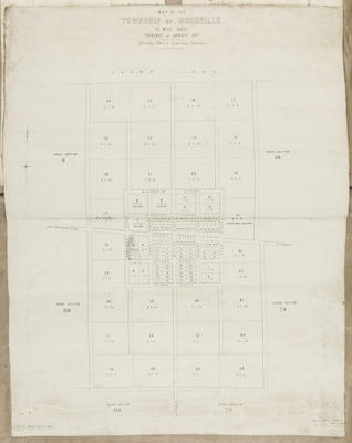
Map, Township of Woodville
Maker
District Lands & Survey office Napier
Production date
10 Dec 1874
Current rights
Public Domain
See full details
Object detail
Brief Description
Map of the township of Woodville.
Seventy mile bush, town & suburban sections.
Land lots and area sizes around Fergusson Street, Ross Street and Bowen Street.
Seventy mile bush, town & suburban sections.
Land lots and area sizes around Fergusson Street, Ross Street and Bowen Street.
Production date
10 Dec 1874
Production place
Production period
Production technique
Media/Materials description
Printed on paper, backed with linen. Ink.
Media/Materials
Measurements
Height x Width: 695 x 535mm
Classification terms
Subject period
Subject date
10 Dec 1874
Current rights
Public Domain
Credit line
gifted by the Hawke's Bay Farmers Co Operative Association
Other number(s)
m74/37/1/157, 74518


Public comments
Be the first to comment on this object record.