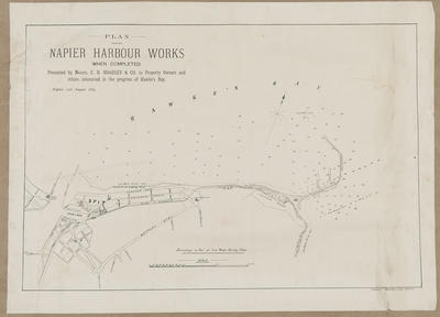
Sketch plan, Napier breakwater harbour
Maker
Herald Lithography
Dinwiddie, Walker and Company Limited
Current rights
Public Domain
See full details
Object detail
Brief Description
Sketch plan of the Napier breakwater harbour, when completed.
Shows depth soundings in feet at low water spring tides, roads around Coote Road, the harbour area, where 5 wharves are shown West of the breakwater, which extends almost out to Auckland Rock. The crib work for protecting the beach is noted on the beach on Hardinge Road - Ahuriri.
Undated.
Shows depth soundings in feet at low water spring tides, roads around Coote Road, the harbour area, where 5 wharves are shown West of the breakwater, which extends almost out to Auckland Rock. The crib work for protecting the beach is noted on the beach on Hardinge Road - Ahuriri.
Undated.
Production place
Production technique
Media/Materials description
Printed on paper with black ink.
Media/Materials
Measurements
Height x Width: 420 x 565mm
Classification terms
Subject date
Unknown
Current rights
Public Domain
Credit line
gifted by the Hawke's Bay Farmers Co Operative Association
Other number(s)
m74/37/1/80, 74169


Public comments
Be the first to comment on this object record.