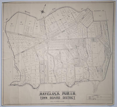
Map, Havelock North Town Board District
Current rights
Public Domain
See full details
Object detail
Brief Description
Map, Havelock North Town Board District.
Cadastral map showing water mains, sewer lines, land lots with area sizes, rivers, streets in the Tanner Street, Gilean Street, Campbell Street, Te Aute Road and the old Ngaruroro River bed area.
The Here Here Stream is to the south west merging into the old Ngaruroro River bed.
Scale is at six chains to the inch.
No date but was not made before 1922.
Production place
Production technique
Media/Materials description
Printed on paper with black ink.
Media/Materials
Measurements
Height x Width: 500 x 535mm
Classification terms
Current rights
Public Domain
Caption
Collection of Hawke's Bay Museums Trust, Ruawharo Tā-ū-rangi, 72626
Credit line
gifted by Mr S Grant
Other number(s)
7078, 72626


Public comments
Be the first to comment on this object record.