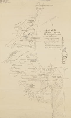
Map, Te Ahuriri Lagoon
Current rights
Public Domain
See full details
Object detail
Brief Description
Map, Te Ahuriri Lagoon.
Map of Te Ahuriri Lagoon - Ko Te Wanganui O Roto, locality names from tracing of 1881 survey and 1856 - 59 surveys.
Shows the Tutaekuri River, Ko Purimu and Taipo Creek at the South end of the map to Meeanee Spit, Kopaki, Maraetara and Poroairaa - Petane Bethany, to the North.
Scale is at 40 chains to the inch.
Production technique
Media/Materials description
Printed on paper with black ink.
Media/Materials
Measurements
Height x Width: 640 x 380mm
Classification terms
Subject period
Subject date
1859
Current rights
Public Domain
Caption
collection of Hawke's Bay Museums Trust, Ruawharo Tā-ū-rangi
Other number(s)
5587(a), 71122


Public comments
Be the first to comment on this object record.