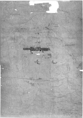
Map, Māori fortifications
Maker
Sinclair, Andrew
Production date
1863
Current rights
Public Domain
See full details
Object detail
Brief Description
Sketch map of Māori fortifications, Rangiriri, drawn by Māori in 1863. Attested as a true copy and signed by Andrew Sinclair, Chief Government Surveyor. The map shows the Waikato River, Lake Waikere and the fortifications at center bordering the Waikato River and Lake Waikere. Rifle pits are shown around the fortification area, and two gunboats - the Avon and the Pioneer - are visible on the river.
Production date
1863
Production place
Production period
Production technique
Media/Materials description
Hand drawn in pencil on paper backed with cardboard.
Media/Materials
Measurements
Height x Width: 655 x 485mm
Height x Width: 575 x 405mm
Height x Width: 575 x 405mm
Classification terms
Subject person
Subject period
Subject date
1863
Current rights
Public Domain
Other number(s)
MMC216, 5044, 71013


Public comments
Be the first to comment on this object record.