Map, New Zealand
Maker
Hay, James Augustus Louis
Production date
Sep 1892
Current rights
Public Domain
See full details
Object detail
Brief Description
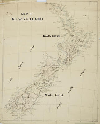
Map of New Zealand by James Augustus Louis Hay dated September 1892.
Map shows the North, Middle (South) and Stewart island with each divided into provinces. Within the provinces are rail lines, mountain ranges, capes and points, and urban areas. The longitudinal and latitudinal grid included.
Map shows the North, Middle (South) and Stewart island with each divided into provinces. Within the provinces are rail lines, mountain ranges, capes and points, and urban areas. The longitudinal and latitudinal grid included.
Production date
Sep 1892
Production place
Production period
Production technique
Media/Materials description
Drawn black ink and watercolour on paper.
Media/Materials
Measurements
Height x Width: 660 x 525mm
Classification terms
Subject period
Subject date
Sep 1892
Current rights
Public Domain
Caption
Collection of Hawke's Bay Museums Trust, Ruawharo Tā-ū-rangi, 69894
Credit line
gifted by Margaret Hay
Other number(s)
m99/97/15, 5779, 69894


Public comments
Be the first to comment on this object record.