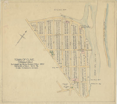
Map, Clive (Waipureku), Hawke's Bay
Maker
Tiffen, Henry Stokes
Current rights
Public Domain
See full details
Object detail
Brief Description
Map of Clive (Waipureku), Hawke's Bay.
Signed by Henry Stokes Tiffen, 1857.
Clive was declared a town on 19 December 1879. Hand drawn from the original.
Area shown is bordered by School Road, Bridge Street and Clive Crescent. The Tuki Tuki River borders the township. Individual lots are numbered.
Signed by Henry Stokes Tiffen, 1857.
Clive was declared a town on 19 December 1879. Hand drawn from the original.
Area shown is bordered by School Road, Bridge Street and Clive Crescent. The Tuki Tuki River borders the township. Individual lots are numbered.
Production technique
Media/Materials description
Drawn in coloured pencil on paper.
Media/Materials
Measurements
Height x Width: 380 x 410mm
Classification terms
Subject person
Current rights
Public Domain
Caption
Collection of Hawke's Bay Museums Trust, Ruawharo Tā-ū-rangi, 69535
Credit line
gifted by Mr G A Dyett
Other number(s)
m66/31(b), 5575, 69535


Public comments
Be the first to comment on this object record.