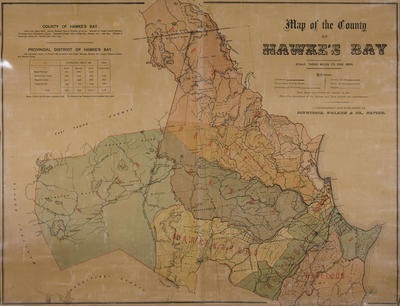
Map, County of Hawke's Bay
Maker
Dinwiddie, Walker and Company Limited
Production date
1881
Current rights
Public Domain
See full details
Object detail
Brief Description
The map of the County of Hawke's Bay depicts railways, unsurveyed county roads, boundary of the province, county roads, tracks, land blocks around Napier, Havelock North district, Maraekakaho district, Puketapu district and Petane district.
Hawke's Bay is 2,136 square miles. The census of 1881 records the population of the Napier Borough as 2,896 European males and 2,860 European females. The Māori population in the provincial district number about 4,000.
Date, unknown.
Hawke's Bay is 2,136 square miles. The census of 1881 records the population of the Napier Borough as 2,896 European males and 2,860 European females. The Māori population in the provincial district number about 4,000.
Date, unknown.
Production date
1881
Production place
Production period
Production technique
Media/Materials description
Printed on paper backed with linen and black ink.
Media/Materials
Measurements
Height x Width: 570 x 720mm
Classification terms
Subject person
Subject period
Subject date
1881
Current rights
Public Domain
Credit line
gifted by George Nelson
Other number(s)
5555, m65/19, 69021


Public comments
Be the first to comment on this object record.