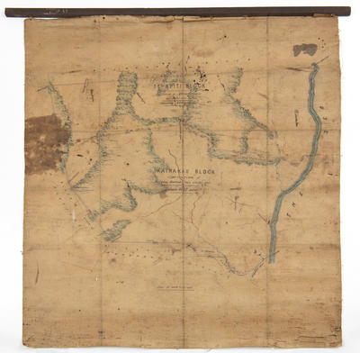
Map, Te Apiti and Kairakau Runs
Production date
Pre 20th Century
Current rights
Public Domain
See full details
Object detail
Brief Description
Map of Te Apiti and Kairakau Runs.
Shows rivers, sea, bush areas, block boundaries around Apiti River, Mangakuri River, Ponui Creek, Te Kahora, Mangakuri district, Kairakau block - application of Morena Hawea Me Etaha atu, consisting of 8,042 acres and Te Apiti block application of Morena Hawea, 6,068 acres.
Survey lines have been noted from Taupata along Omarukaraka, Hikurua and Manuwhiri extending West to Wakakakaruki then South East to Kakatewai.
Production date
Pre 20th Century
Production place
Production period
Production technique
Media/Materials description
Printed on paper with linen backing and ink and watercolour.
Media/Materials
Measurements
Height x Width: 835 x 735mm
Classification terms
Subject person
Subject period
Subject date
Pre 1900
Current rights
Public Domain
Credit line
gifted by Mrs T Sunderland
Other number(s)
m79/55, 5707 a, 68886


Public comments
Be the first to comment on this object record.