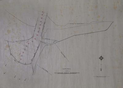
Plan, Napier Inner Harbour
Production date
Circa 1920
Current rights
Public Domain
See full details
Object detail
Brief Description
Plan of Napier Inner Harbour, circa 1920.
The plan shows the entrance to Napier Inner Harbour, railway line along breakwater and quay, crib work along beach, the Eastern and Western moles, Meeanee Quay, West Quay, and two lines of filling. The plan also shows bore sections with the entrance way divided into 17 areas showing boulders and shingle along the seafloor.
Scale is 4 chains to 1 inch.
Unsigned.
Production date
Circa 1920
Production place
Production period
Production technique
Media/Materials description
Drawn and handwritten black ink on tracing paper
Measurements
Height x Width: 510 x 725mm
Classification terms
Subject person
Subject period
Subject date
Circa 1920
Current rights
Public Domain
Caption
Collection of Hawke's Bay Museums Trust, Ruawharo Tā-ū-rangi, [65274]
Credit line
gifted by George Nelson
Other number(s)
5538, m65/19, 65274


Public comments
Be the first to comment on this object record.