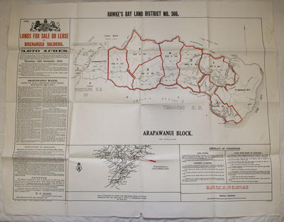
Map, Arapawanui Block
Maker
Department of Lands & Survey
Marks, Marcus
Production date
12 Dec 1918
Current rights
Public Domain
See full details
Object detail
Brief Description
Map attributed to the Department of Lands and Survey of Arapawanui Block dated 12 December 1918.
Map shows lands for sale or lease to discharged soldiers. Includes 3,670 acres divided into seven sections. Distance about 20 miles north from Napier by the main Wairoa Road and 22 miles by the Tongoio Settlement and Arapawanui Roads. Written material on left and right hand sides.
Printed by Marcus F Marks.
Collection
Production date
12 Dec 1918
Production place
Production period
Production technique
Media/Materials description
Printed on paper with black and red ink.
Media/Materials
Measurements
Height x Width: 590 x 795mm
Classification terms
Subject person
Subject period
Subject date
12 Dec 1918
Current rights
Public Domain
Credit line
gifted by Williams and Kettle Limited
Other number(s)
m2007/86/226, 6808, 56981


Public comments
Be the first to comment on this object record.