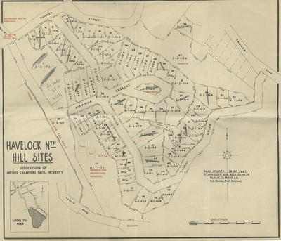
Map, Havelock North Hill Sites
Maker
Williams & Kettle Ltd
Davies, Henry Cornwell
Current rights
All Rights Reserved
See full details
Object detail
Brief Description
Map of Havelock North Hill Sites. Subdivision of Messrs Chambers Brothers Property. Block IV Te Mata. The map shows: Awarua Crescent; Tainui Drive; Tanner Street; Joll Road; and Tauroa Road. Reserve for recreation grounds. Locality map.
Surveyor, Henry Cornwell Davies.
Date, unknown.
Surveyor, Henry Cornwell Davies.
Date, unknown.
Collection
Production place
Production technique
Media/Materials description
Printed on paper with black ink.
Media/Materials
Measurements
Height x Width: 430 x 502mm
Classification terms
Subject person
Subject date
Unknown
Current rights
All Rights Reserved
Credit line
gifted by Williams & Kettle
Other number(s)
m2007/86/323-326, 6905 - 6908, 56895


Public comments
Be the first to comment on this object record.