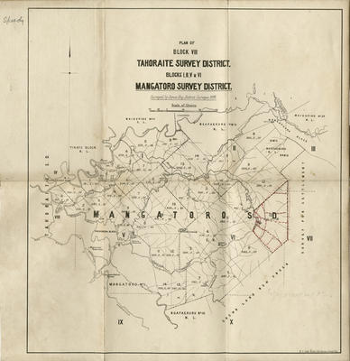
Map, Block VIII Tahoraite Survey District and Blocks 1, II, V & VI, Mangatoro Survey District
Maker
Williams & Kettle Ltd
Hay, James
Production date
1898
Current rights
All Rights Reserved
See full details
Object detail
Brief Description
Map of land block Ngapaeruru number 1 (Mangatoro).
Block VIII Tahoraite Survey District & Blocks 1, II, V and VI, Mangatoro Survey District. Surveyed by James Hay, District Surveyor, 1898. District bounded by Tiratu Block; Tahoraite S.D.; Waikopiro No 1; Ngapaeruru No 2; Mangapuaka Block; Waikopiro No 2; Crown Land; Ngapaeruru; Mangatoro. Close to Dannevirke and Herbertville.
Folded up to form a small booklet.
Collection
Production date
1898
Production place
Production period
Production technique
Media/Materials description
Printed on paper with black and red ink. Brown leather cover.
Media/Materials
Measurements
Height x Width: 280 x 262mm
Classification terms
Subject period
Subject date
1898
Current rights
All Rights Reserved
Credit line
gifted by Williams & Kettle
Other number(s)
m2007/86/89, 6564, 46461


Public comments
Be the first to comment on this object record.