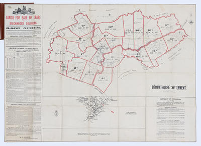
Map, Crownthorpe Settlement
Maker
Department of Lands & Survey
Production date
18 Dec 1920
Current rights
Public Domain
See full details
Object detail
Brief Description
Map of Crownthorpe Settlement, lands for sale or lease to discharged soldiers. 8,805 acres. Distance about 21 miles from Napier and 16 from Hastings. The settlement is bounded by Sherenden Settlement (T S Guthrie & A Dysart leasees), Matapiro Block (F M Nelson owner), Whana Whana Road, Matapiro Block (W Shrimpton owner); Pukehamoamoa Block. Written material on left and right hand sides. Folded up to form a small booklet.
Collection
Production date
18 Dec 1920
Production place
Production period
Production technique
Media/Materials description
Printed on paper with black and red ink. Linen cover.
Media/Materials
Measurements
Height x Width: 655 x 870mm
Classification terms
Subject person
Subject date
18 Dec 1920
Current rights
Public Domain
Credit line
gifted by Williams & Kettle
Other number(s)
m2007/86/85, 6560, 46450


Public comments
Be the first to comment on this object record.