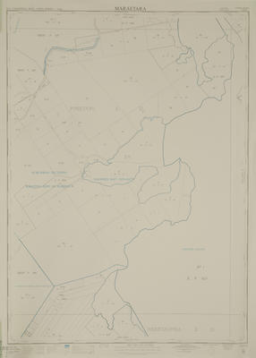
Map, Maraetara
Maker
Wagner, B C
Gough, Robert Phillip
R E Owen, Government Printer
Production date
May 1964
Current rights
Public Domain
See full details
Object detail
Brief Description
Map, Maraetara. N.Z.M.S 189A Maraetara. Napier Series Sheet 3. L & S Ref: 17/389.
Cadastral map showing land district boundaries, survey district boundaries, meridional circuit boundaries, national park boundaries, city - borough boundaries, DP - deposited plans numbers, land area sizes around the Puketapu Survey District, Heretaunga Survey District, Ahuriri Lagoon, Suburban sections western side of Harbour, Puketapu Crown Grant District, Seafield Road, Holts Road.
Cadastral map showing land district boundaries, survey district boundaries, meridional circuit boundaries, national park boundaries, city - borough boundaries, DP - deposited plans numbers, land area sizes around the Puketapu Survey District, Heretaunga Survey District, Ahuriri Lagoon, Suburban sections western side of Harbour, Puketapu Crown Grant District, Seafield Road, Holts Road.
Edition/State/Version
First Edition
Production date
May 1964
Production place
Production period
Production technique
Media/Materials description
Printed on cartography paper.
Media/Materials
Measurements
Height x Width: 915 x 720mm
Classification terms
Subject person
Subject date
May 1964
Current rights
Public Domain
Caption
collection of Hawke's Bay Museums Trust, Ruawharo Tā-ū-rangi
Credit line
gifted by the Alexander Turnbull Library
Other number(s)
6251, m2003/46/65, 24052


Public comments
Be the first to comment on this object record.