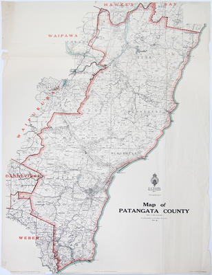
Map, Patangata County
Maker
Department of Lands & Survey
Wicks, A J
Burnley, F D
Walshe, Harry Edward
Loney, G H
Production date
1934
Current rights
Public Domain
See full details
Object detail
Cadastral map showing land district boundaries, survey district boundaries, land area sizes around the Weber county, Tautane, Porangahau, Blackhead, Pourerere, Tuki Tuki River, Mangakuri River and Elsthorpe area. Includes Motu o Taraia, Oero, Waimarama and Blackhead.
Waipukurau is in the adjoining Waipukurau district area.
New Zealand gazette ref: 1927, p2929.


Public comments
Be the first to comment on this object record.