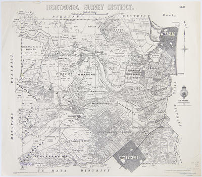
Map, Heretaunga Survey District
Maker
Department of Lands & Survey
Dick, R G
Paul, E V
McMillan, T S
Walshe, Harry Edward
Production date
1940
Current rights
Public Domain
See full details
Object detail
Boundaries: Puketapu District, Matapiro District, Clive District, Te Mata District. Shows county boundaries, land district boundaries, survey district boundaries, meridional circuit boundary, state forest boundary, city - borough - town boundaries and subdivision lot nut numbers in the Okawa C G D, Wharerangi, Taradale Town Board District, Napier, Omarunui, Pirau No 1, Ōmāhu, Ohiti-Waitio, Fernhill, Ngatarawa, Rahuirua, Waipiropiro, Ohikakarewa, Waiohiki, Rotopounamu, Karamu Reserve, Heretaunga Block, Te Awa O Te Atua and Hastings.


Public comments
Be the first to comment on this object record.